spacestr

🔔 This profile hasn't been claimed yet. If this is your Nostr profile, you can claim it.

Edit
OsmAnd (Unofficial)
Member since: 2026-10-15
OsmAnd (Unofficial)
OsmAnd (Unofficial) 27m

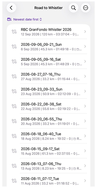
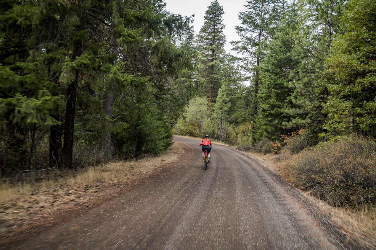
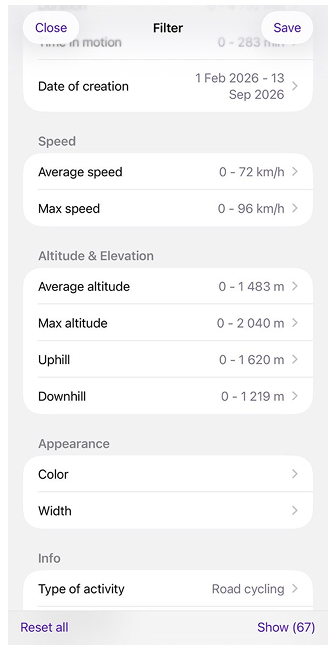
Organizing Your Tracks with Smart Folders A September morning in Vancouver. More than a thousand riders roll out of Stanley Park for the RBC GranFondo Whistler: 122 kilometres of the Sea to Sky Highway, closed to traffic, with Howe Sound on one side and the mountains on the other. Past Squamish, the road starts to climb and keeps climbing all the way to Whistler. You cross the line near the top of the results, and everyone says the same thing: you were lucky. With the weather, the wind, the group. You know better. That result is made of dark February mornings on the seawall, Sunday climbs up Cypress, and long rides to Squamish and back, all recorded in OsmAnd one track at a time. Let’s see what a season of training looks like once Smart Folders put it in order. Photo by Ben Guernsey on Unsplash A Folder That Fills Itself​ A training season doesn’t arrive neatly packed. Between the rides sit a few hikes and a drive to Whistler, and the Tracks tab lists everything by date, with no idea which recordings mattered. A Smart Folder works the other way round: you describe the tracks you want, and OsmAnd collects them. The description is a filter that can check almost anything a track knows about itself, including length, duration, speed, elevation, date, location, activity type, and even heart rate. Set the activity to road cycling, limit the dates from February to race day, save the result as “Road to Whistler”, and the whole season lands in one place while the hikes stay out. New rides join the folder on their own. The tracks themselves stay where they were, so deleting the folder never deletes a ride. One catch: activity type is stored in each track, and older recordings may not have one. If some rides are missing, set their activity and refresh the folder. One Collection, Many Views​ Sixty-seven rides in one folder is tidier than a few hundred, but it’s still a list. Organize by turns that list into groups, sorting the folder by a single parameter: activity, date, location, speed, altitude and elevation, or sensor data such as heart rate. The tracks don’t move anywhere; only the way you look at them changes. Group the season by nearest city, and you see where the rides began: most of them in Vancouver, a handful from West Vancouver, where the long runs to Squamish set off from Horseshoe Bay, and four from Whistler, once summer made it worth driving up for the climbs. Switch to month and year, and the same folder turns into a calendar, from a cautious February to a crowded August. Each group shows how many tracks it holds, and empty groups don’t appear at all. Below the list, OsmAnd adds everything up: tracks, distance, climbing, descent, and time in the saddle. It does this for the whole folder and for every group you open. That’s where the season starts answering questions. Drawing the Lines Yourself​ Months and cities come with natural borders. Distance doesn’t. Is a 55 km ride a long one or just a solid Tuesday? For length, duration, speed, and altitude, OsmAnd lets you decide where one group ends and the next begins. Pick one of these parameters, and a slider asks for a step size. Drag it, and the groups rearrange behind it as you go. With a 50 km step, most of the season piles into the first group, which is honest but not very revealing. Bring it down to 20 km, and the season sorts itself out: short morning laps along the seawall, a big block of loops around UBC, the climbs on Cypress and Seymour further up, the long runs to Squamish, and, at the very end, two tracks of almost exactly the same length: the course recon in August and the race itself. Some of this is free for everyone: grouping by activity, year of creation, and nearest city. The rest, including the monthly calendar from the previous section and every parameter with a step size, comes with OsmAnd Pro. Without a subscription, you can still open these options and preview how the tracks would split before deciding. If a subscription ends, the grouping you’ve already applied stays in place, and only changing it requires Pro again. Keeping It in Shape​ The race is over, but the folder doesn’t retire with it. It keeps watching for rides that match its rules, and if the list ever looks out of date, a quick refresh brings it back in line. When the next season starts, there’s no need to build anything new. Edit the filter, move the dates forward, and the same folder starts collecting a new story. Groups are useful beyond reading, too. Any of them can go straight onto the map, so a whole August of riding appears at once, from the seawall to the climbs above Whistler, every route drawn on top of the others. A group can also be exported in one go, which is handy when a coach asks to see your month and doesn’t want a dozen separate files. If you plan the next season on a bigger screen, Smart Folders also appear in OsmAnd Web once Settings are synced through OsmAnd Cloud. They keep working best with common parameters such as activity, dates, or distance. The Answer to the Question​ So, was it luck? Open February, and the folder answers modestly: five rides, 103 km, just over five hours on the bike, and 839 metres of climbing. Then open August: twelve rides, 577 km, a full 24 hours in the saddle, and 6,806 metres of climbing, including the day you rode the entire race course just to see how it would feel. The whole season fits into a single line at the bottom of the folder: 67 rides, 2,923 km, and more than 33,000 metres of climbing. That’s nearly four times the height of Everest, collected one Cypress hairpin at a time. No tailwind delivers that. So the next time someone tells you how lucky you were, there’s no need to argue. Just open the folder and hand them your phone. Share Your Story Every track in OsmAnd has a person and a story behind it. If you’d like to share yours on our blog, whether it’s a long journey, a season of training, or a route you simply love, we’d be glad to hear from you. Write to Tina, and we’ll make it happen together. We appreciate your interest in us and thank you for taking the time to read this article. Join us on social media to keep up to date with the latest news and share your experiences. Your opinion is important to us. Follow OsmAnd on Facebook, TikTok, X (Twitter), Reddit, and Instagram! Join us at our groups of Telegram: (OsmAnd News channel), (EN), (IT), (FR), (DE), (UA), (ES), (BR-PT), (PL), (AR), (TR). https://osmand.net/blog/smart-folders #smartfolders #folder #whistler #squamish #vancouver #february #skyhighway #howesound #stanleypark #group #rss #feeds #linksharing #qwibbit
#smartfolders #folder #whistler #squamish #vancouver
OsmAnd (Unofficial)
OsmAnd (Unofficial) 9d

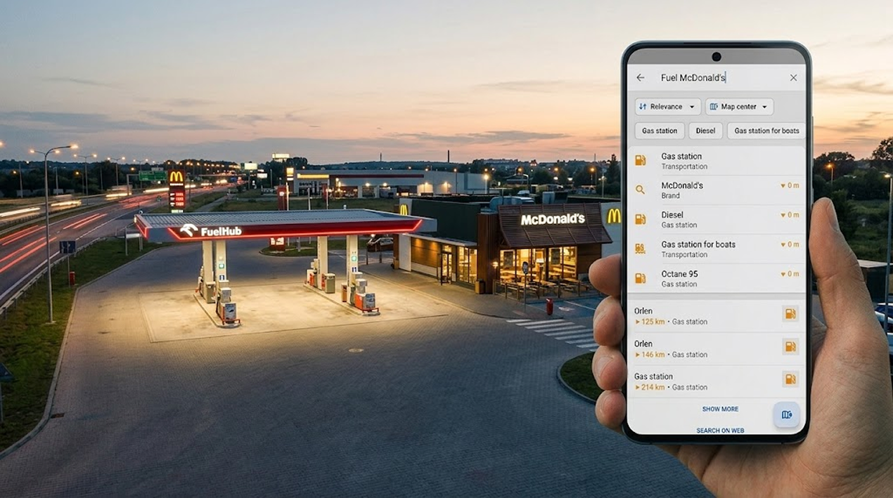
Why Offline Search Is So Hard If you have ever typed an address into OsmAnd and got a street in another town — or nothing at all — you are not alone. Search has been the most common complaint we hear, and in our 2026 survey it came up again and again in every language. So this year we did not patch it once more. We built a new search engine from scratch, and it comes to everyone with OsmAnd 5.5. If you don't want to wait, it is already in our nightly builds. The video above tells the whole story in 23 minutes. Below is the short version, with a few interactive demos so you can play with the same ideas the new engine uses. What Changes for You​ Addresses typed your way. Unter den Linden 10 or 10 Unter den Linden, S Mountain Blvd for South Mountain Boulevard, a postcode or a state instead of a town. Typos corrected. Misspell a word and search offers the right one: leopoldstrase 10 → Leopoldstraße 10, mnuc → MĂŒnchen. Suggestions as you type. Start a word and search offers the most common words that continue it — tap one instead of typing the rest. Public services by the name people use. DMV finds motor vehicle offices and NHS finds NHS clinics, even when the map lists the organisation only as the operator. Categories in more words and languages. Categories match common synonyms and work in your language, in English, and in the local language: with the app in English, both school and Schule find schools in Germany. Places next to places. Fuel McDonald's finds gas stations with a McDonald's nearby; Shell on a named street; two streets that cross. Faster and measured. The search itself is about five times faster, and every change now runs against 137,000 real searches in 28 test sets — 99.5% of them are found. Why Is This So Hard Offline?​ Google can afford to be clever: every query goes to a server that has learned from billions of searches, corrections, and taps. OsmAnd has no server. Everything happens on your phone, inside the map files you downloaded — so the phone itself has to work out what you meant. And addresses have no grammar book. Every country writes them its own way, and people mix the parts in any order. The same line of text can mean two different places: One line of text, many readings Real queries from our tests. The colour shows what each word turns out to be. «5 Ave New York» 5 AvestreetNew Yorktown— Fifth Avenue in New York City or5houseAve 
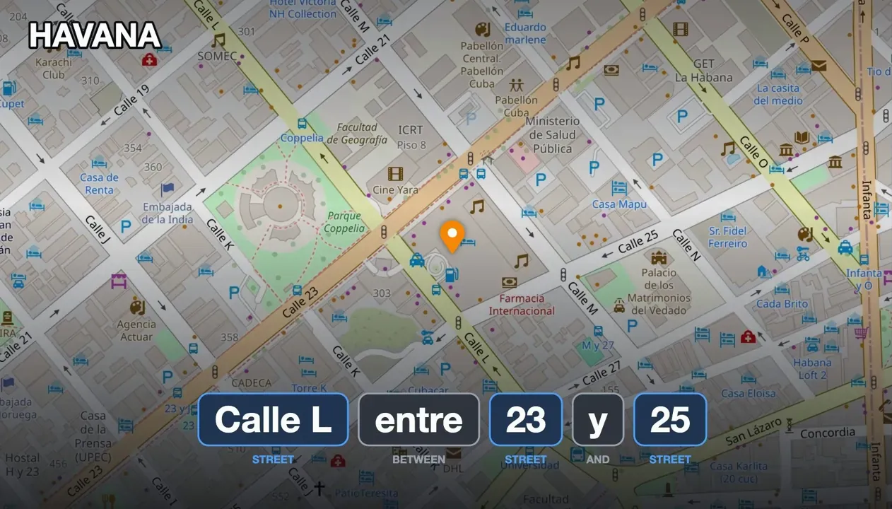
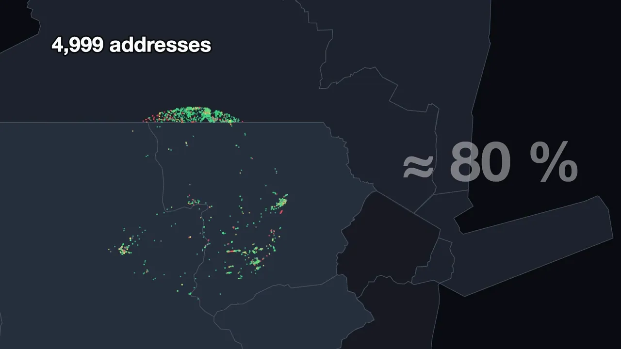
 New Yorkstreet— house 5 on New York Avenue «Pennsylvania Avenue, Utah» Pennsylvania AvenuestreetUtahstate— a street named after one state, in another orPennsylvaniastate— also a state on the other side of the country — and "Avenue" is in over a million street names «48 Free Street, Portland, Maine» 48houseFree StreetstreetPortlandtownMainestate— the state of Maine orMainestreet— there is also a Maine Street, 37 km away «New Philadelphia» New Philadelphiatown— a town in Ohio orNewstreetPhiladelphiatown— New Street in Philadelphia «Calle 20 301, MĂ©rida» Calle 20street301houseMĂ©ridatown— the first number is the street, the second the house «Rue du 8 Mai 1945» Rue du 8 Mai 1945street— two numbers, and neither is a house «14-54 31st Road, Queens» 14-54house31st RoadstreetQueenstown— one house number with a dash «Calle L entre 23 y 25, La Habana» Calle Lstreetbetween 23 and 25streetLa Habanatown— no house number at all — just the streets around it Same place, different text «23 South 2nd Street, Saint Clair» = «Saint Clair, South 2nd Street 23» «S Mountain Blvd» = «South Mountain Boulevard» «Hemauerstraße» = «Hemauer Straße» «Mcdonalds» = «McDonald's» First, Measure​ For years every release fixed some search bugs, and every year 50 to 90 new ones came in. Users told us almost nothing works; we could not reproduce a single bug ourselves. So in 2025 we stopped guessing and built a test bench: take thousands of real addresses from the map, type each one the way a person would, and count how many are found. The first honest number was about 80%. Every user report with a real address became another test — and the bench, not our feeling, started deciding what is fixed. The Old Way: a Librarian​ The old search worked like a librarian: find the town, walk along its shelf of streets, open the street, find the house. It works well in a small town. It works much worse when the town is London — one shelf with 56,266 streets — or when there is no town at all and a single word can be a village, a street, or a hospital. Try it: The librarian How the old search looked for an address. Real data from OsmAnd maps — the same scenes as in the video. The keyWhich word?A small townLondonOne word Back AutoplayNext step 1 of 21 Every search starts with a key: take the rarest word, find every place that has it, and let the other words filter. Every address that broke got its own patch: townships, word order, abbreviations. Each patch fixed one address and broke another, and together they became slow and fragile. One user with eighty maps installed waited more than two minutes for the right result. The New Idea: Put the Words on the Map​ We are searching a map, after all. So instead of walking shelves, the new engine lights up every word of the query on the map, and looks for the places where the lights meet. A street and its town meet because their areas overlap; a McDonald's and a gas station meet because they stand next to each other. Since June 2026 every street and every town in OsmAnd maps carries its own area for exactly this. Here are the real objects the engine finds in Portugal for one long query. Pick the words and watch the map: Words on the map Real objects OsmAnd found in Portugal for the query «Travessa Santo AntĂłnio Rua Joaquim Ribeiro Carvalho Portugal». Pick words: each one lights up the objects that have it. White dots are where all chosen words meet in one object. TravessaSantoAntĂłnioRuaJoaquimRibeiroCarvalhoPortugal The Zipper​ Comparing every object of one word with every object of another would take hundreds of millions of checks — more than half a minute for a single search. The trick is the same one every web map uses: tiles. The world is cut into four squares, each of them into four again, and so on, and every tile gets a number along a Z-shaped curve. Two tiles never overlap partially — they are either apart or one sits inside the other. So each word becomes a sorted list of tile numbers, and two words are joined by walking both lists at once, like a zipper. Pairs that can't meet are never looked at: The zipper Each word becomes a sorted list of tile numbers on the Z-curve. Walk both lists at once: the smaller number steps forward, equal numbers mean a shared tile. Change the level to see how the lists grow. TravessaSantoAntĂłnioRuaJoaquimRibeiroCarvalhoPortugal×TravessaSantoAntĂłnioRuaJoaquimRibeiroCarvalhoPortugallevel 9 An advanced version of the zipper jumps between tile levels — a town is a big tile, a street a small one — and skips whole regions where the other word has nothing. Half a minute became 50 milliseconds. Tetris With Words​ Long queries, like a crossing of two streets, add one more twist. Each object covers only some of the words, so the answer is a set of pieces that covers every word exactly once — and also meets on the map. It is a classic hard problem, the same family as Sudoku. The engine plays it like Tetris: pieces dock into a row, every docking is checked on the map, and a row that drops to zero disappears together with everything that could have been built on it. This is the engine's real trace for Travessa de Santo AntĂłnio, Rua Joaquim Ribeiro de Carvalho, Portugal: Tetris with words 8 words, 8 columns. A piece is a group of objects that cover the same words; its number is how many places stand behind it. Pieces dock into a row until every word is covered — or until no places are left. Back AutoplayNext piece 0 of 30 Travessa Santo AntĂłnio Rua Joaquim Ribeiro Carvalho Portugal 1,354 places Portugal 1,354 A piece falls into a new row: Portugal — 1,354 places. Next pieces Rua Joaquim Ribeiro Carvalho Travessa Santo AntĂłnio new row: Ribeiro Portugal Places that still meet Where We Are Now​ The new engine went from its first test run in July 2026 to beating the old search two days later, and kept climbing. Today 99.5% of the 137,000 test searches are found. In Pennsylvania, where we started, the addresses we could not find went from 206 to 40 to 7 — and those last seven are broken in OpenStreetMap itself. It also handles queries the old search never could, like a McDonald's next to a gas station. Not everything is solved. Havana's Calle L, between 23 and 25 has no house number, only the two streets around it, and we still can't find it. Ranking, typos, and common words each deserve a story of their own. Try It and Help​ The new search comes with OsmAnd 5.5. You can try it today in our nightly builds, and as always the code is on GitHub. How to use search is described in the Search documentation. Tell us what you typed. When search can't find something, send us the exact query to [email protected] or open an issue on GitHub — every miss becomes a test. Help the map. A street without a name can't be found, and streets inside a town without a boundary may be missed. Add names and draw boundaries in OpenStreetMap. The video has subtitles in 7 languages and dubbed audio in German, French, Italian, and Spanish. We appreciate your interest in us and thank you for taking the time to read this article. Join us on social media to keep up to date with the latest news and share your experiences. Your opinion is important to us. Follow: Follow OsmAnd on Facebook, TikTok, X (Twitter), Reddit, and Instagram! Join: Join us at our groups of Telegram (OsmAnd News channel), (EN), (IT), (FR), (DE), (UA), (ES), (BR-PT), (PL), (AR), (TR). Get: https://osmand.net/blog/offline-search-video #hardoffline #newyork #search #street #avenue #maine #newphiladelphia #every #linden #osmand #rss #feeds #linksharing #qwibbit
#hardoffline #newyork #search #street #avenue
OsmAnd (Unofficial)
OsmAnd (Unofficial) 15d

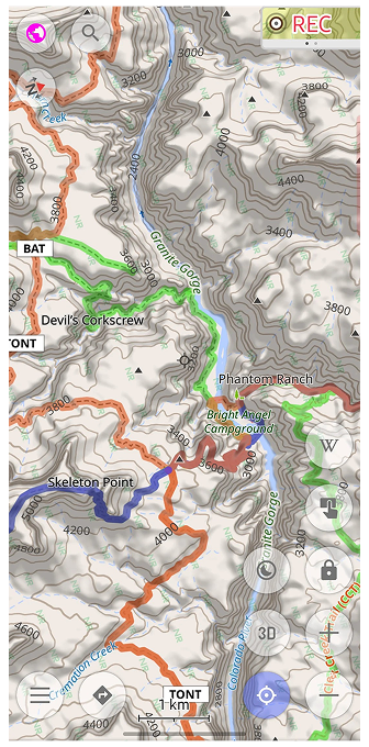
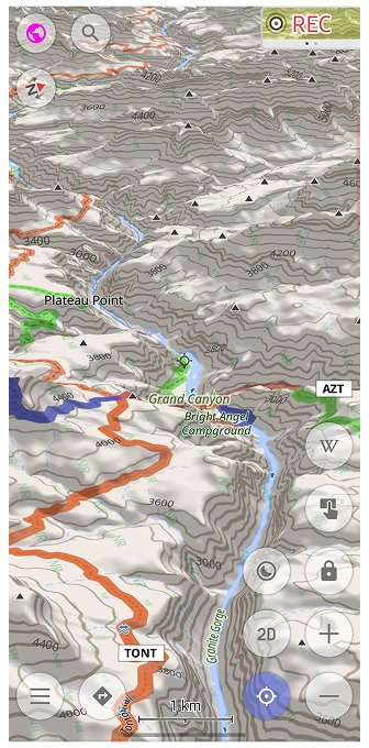
Your North America Terrain Maps Can Look Much Sharper If you hike, ski, or drive in North America, your OsmAnd terrain may already be much sharper than you think. Since spring 2026, terrain maps and contour lines for the United States (including Alaska), Canada, and Mexico are built from high-resolution national elevation data. If you have not updated these maps since then, you are still looking at the old, smoother relief. What Changed​ The new maps use elevation data with about 10 m resolution in the mainland United States and about 30 m in Alaska and most of Canada and Mexico. In practice, that means smaller ridges, narrower gorges, and steeper cliffs show up where the map used to smooth them out. The update covers two map types: Terrain maps (3D) — the base for 3D relief, Hillshade, and Slope layers. Contour lines — regenerated from the same new data, so they match the relief exactly. More detail takes a bit more space: updated maps are up to one and a half times larger than before. Data: USGS 3D Elevation Program (via The National Map and OpenTopography), including data from Natural Resources Canada (NRCan) and INEGI (Mexico). Updated Regions​ United States, including Alaska Most of Canada and Mexico See It in the Grand Canyon​ Few places test a terrain map like the Grand Canyon. Seen from above, the side canyons branch out in fine detail, and the contour lines follow every bend of the walls down to the Colorado River. Tilt the map into 3D, and the canyon rises off the screen: Plateau Point, Skeleton Point, and the trail down to Phantom Ranch sit right where the terrain says they should. Works Offline​ Terrain maps are stored on your device, just like the rest of your OsmAnd maps. Once downloaded, the relief, contour lines, and 3D view keep working without an internet connection, which is handy at the bottom of a canyon, where signal is rarely part of the scenery. How to Get the Update​ Terrain maps downloaded before May 2026 still contain the old data. Open the Updates tab in Maps & Resources: if terrain or contour line maps for these regions are listed, update them. There is no need to delete the old files first. If you do not have them yet, download the Terrain map (3D) and Contour lines for the regions you need. Terrain and contour line maps require OsmAnd Maps+ or Pro; 3D relief requires OsmAnd Pro. Questions or Issues​ If something looks off or you have questions, contact OsmAnd support at [email protected], or visit the Support page for more help options. We appreciate your interest in us and thank you for taking the time to read this article. Join us on social media to keep up to date with the latest news and share your experiences. Your opinion is important to us. Follow: Follow OsmAnd on Facebook, TikTok, X (Twitter), Reddit, and Instagram! Join: Join us at our groups of Telegram (OsmAnd News channel), (EN), (IT), (FR), (DE), (UA), (ES), (BR-PT), (PL), (AR), (TR). Get: https://osmand.net/blog/north-america-terrain #northamerica #terrainmaps #unitedstates #map #osmand #data #alaska #grandcanyon #resourcescanada #elevation #rss #feeds #linksharing #qwibbit
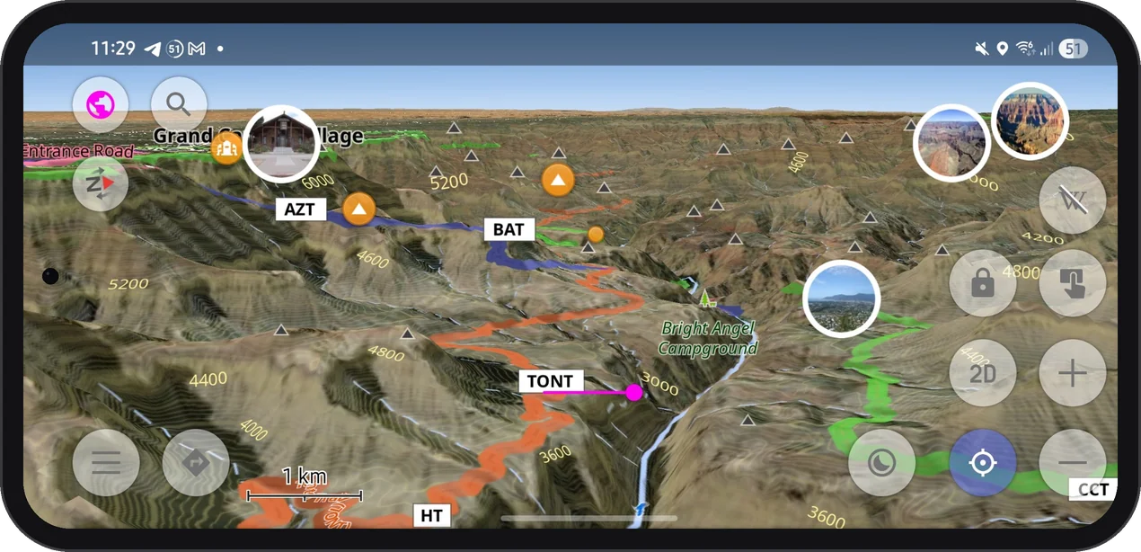
#northamerica #terrainmaps #unitedstates #map #osmand
OsmAnd (Unofficial)
OsmAnd (Unofficial) 21d

Discontinued "Merged" Maps. What Changed and What to Do Discontinued "Merged" Maps OsmAnd has discontinued "merged" maps — large country- or region-level files that were assembled from smaller regional maps. If you have one of these installed, it will no longer receive updates. What Changed​ Previously, some maps were built by merging a set of smaller regional maps into one large file. For example, the full map of Austria was assembled from all of its individual regions; Bavaria (Germany) was assembled from its smaller sub-regions in the same way. These merged maps are now discontinued. They won't be updated going forward — only the individual regional maps that made them up will continue to receive updates. If you have a recent version of OsmAnd installed, a warning about this will appear automatically in Maps & Resources → Updates. Why This Happened​ As OpenStreetMap data grows more detailed, map files get larger over time. Merged maps — combining dozens of regional files into one — eventually became too large to update and use efficiently, affecting app performance and routing speed. Merging also meant duplication: users downloading a merged map and its individual regions were storing the same data twice. Discontinuing merged maps removes this overlap and keeps map updates faster and more reliable. This wasn't a sudden decision — OsmAnd has been moving toward smaller, region-based maps for some time, and this change is part of that ongoing transition. Which Maps Are Affected​ ▶ Click to view Discontinued Detailed Maps (Argentina, Germany, USA, etc.) Global Countries: Argentina, Austria, Belarus, Belgium, Chile, Democratic Republic of the Congo, Czech Republic, Denmark, Finland, Iran, Mexico, Philippines, South Africa, Sweden, Switzerland, Tanzania. Canada: British Columbia, Ontario, Quebec. France: Auvergne-RhĂŽne-Alpes, Grand Est, Nouvelle-Aquitaine, Occitanie, Provence-Alpes-CĂŽte d'Azur. Germany: Baden-WĂŒrttemberg, Bavaria, Hesse, Lower Saxony. Japan: Chubu, Kanto. Russia: Far Eastern, North Caucasus, Northwestern, Siberian, Southern, Ural, Volga federal districts. USA: Florida, New York. ▶ Click to view Discontinued Roads-Only Maps (UK, Ukraine, Netherlands, etc.) Countries & Regions: Australia & Oceania, Democratic Republic of the Congo, England (UK), Indonesia, Netherlands, Norway, Philippines, South Africa, Ukraine. USA: Florida, New York, Texas. What To Do​ If you have one of the affected maps installed: Check Maps & Resources → Updates a warning about your installed maps. Delete the discontinued merged map from your device. Download the individual regional maps that cover the same area instead. Going forward, updating by region means smaller downloads and keeps your maps current without needing to re-download a large file each time. Questions or Issues​ If you have questions about this change or run into issues after switching to regional maps, contact OsmAnd support at [email protected], or visit the Support page for more help options. https://osmand.net/blog/merged-maps

OsmAnd (Unofficial)
OsmAnd (Unofficial) 21d

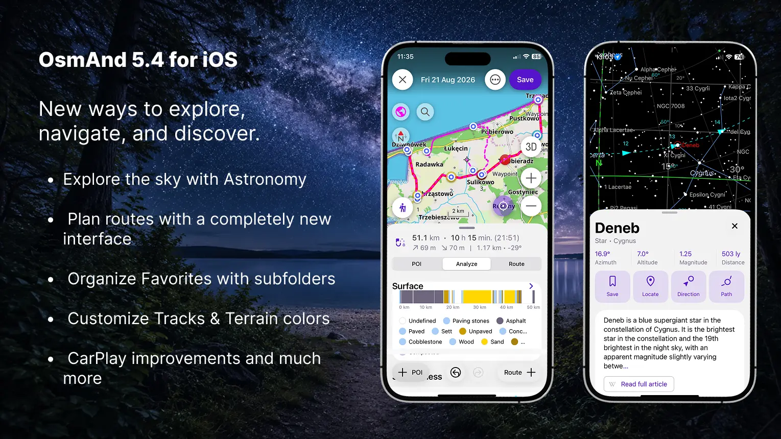
OsmAnd 5.4 (iOS) OsmAnd 5.4 for iOS — Now Available! This update brings a redesigned My Places interface, a rebuilt Plan a Route tool, the new Astronomy plugin, and many other improvements and bug fixes. 🔄 Update Now What's new​ Redesigned "My Places" — with Favorites subfolders, pinned folders, and quicker actions Rebuilt "Plan a Route" — add route and POI points, and combine different route types New Astronomy plugin: star map with a detailed database for each object, visibility graphs, and an observation schedule Added "Terrain shadows" visualization type Edit the color palette for Tracks and Terrain Full icon selection now available for profiles CarPlay improvements and bug fixes Set a default appearance for Track folders Auto-organize tracks by year, length, activity, and more Split multi-track GPX file into separate files on import Others updates and improvements Bug fixes. New "My Places" design​ The My Places screen has been redesigned with a new segmented interface, making it easier to switch between Favorites, Tracks, OSM Edits, and Travel Guides. Favorites now use a folder-based structure with support for subfolders. Folders are organized into Pinned, Visible, and Hidden sections, and frequently used folders can be pinned to the top. Each folder displays useful statistics, including the number of subfolders and points, modification date, and storage size. New sorting options allow folders and points to be arranged by name, date, or distance. Updated action menus provide quicker access to Show on map, Pin or unpin, Rename, Appearance, Share, Move, and Delete. Favorites and entire folders can also be added to Map markers, a Track, or Navigation. Selection mode makes it possible to apply actions to multiple folders and points at once. Tracks provides access to saved, recorded, and imported GPX files from the same redesigned My Places interface, with search, sorting, folder management, statistics, and quick actions for working with individual tracks or multiple selected items. OSM Edits keeps your OpenStreetMap edits, notes, and uploaded changes in a dedicated section. This tab is available when the OSM Editing plugin is enabled. Travel Guides contains bookmarked travel articles and guides, allowing saved travel content to be accessed directly from My Places. The tab appears when multiple guides have been bookmarked. The new search interface also makes Favorites easier to find by displaying their folder, distance, address, and creation date directly in the results. Updated "Plan a Route" interface​ The Plan a Route tool has been rebuilt with a new interface for creating, editing, and analyzing routes. Separate Route + and + POI actions let you add route points or named waypoints and points of interest. Individual route segments can use different routing types, allowing you to combine, for example, cycling, walking, and straight-line sections within the same track. The new panel includes three sections: POI — manage waypoints and points of interest added to the track. Analyze — view the elevation graph, uphill and downhill values, altitude range, speed statistics, and route composition by road type, steepness, surface, and smoothness. Route — view and manage route points and segments. When elevation data is unavailable, it can be calculated using nearby roads or downloaded Terrain maps. The updated route summary also displays distance, estimated travel time, arrival time, elevation gain, and elevation loss. Quick actions provide access to undo and redo, change segment order, reverse the route, append it to an existing track, save a copy, clear all points, or start navigation directly along the planned track. Astronomy plugin​ The Astronomy plugin is now available on iOS. It provides an interactive Star Map with stars, constellations, the Sun, the Moon, planets, nebulae, star clusters, and other deep-sky objects. Explore celestial objects using categories, catalogs, and the Watch now section. Detailed object information, visibility graphs, daily paths, direction indicators, Favorites, and a weekly observation schedule help you find objects and choose the best time for stargazing. Enabled plugin (Menu → Plugins → Astronomy) → Menu → Star map New "Terrain shadows" visualization​ The new Terrain Shadows visualization provides real-time dynamic shading based on 3D terrain geometry. Unlike raster Hillshade maps, the shadows are generated directly on the device and automatically adapt to the current map perspective. This visualization makes mountains, valleys, ridges, and other terrain features easier to distinguish while maintaining a low impact on performance. 3D Relief is required and is enabled automatically when Terrain Shadows is selected. Menu → Configure Map → Topography → Terrain → Visualization → Terrain Shadows Color palette for Tracks and Terrain​ OsmAnd 5.4 for iOS introduces a built-in Color Palette Editor for customizing how track data and terrain layers are displayed. For Tracks, you can create custom palettes for Speed, Altitude, and Slope coloring. Choose between: Custom palettes are also available for Terrain visualizations. You can modify the color scale used for Slope and Altitude, assign colors to specific elevation levels or slope percentages, and add or remove value steps. Hillshade uses a fixed shading algorithm and does not support custom palettes. More icons for profiles​ You can now choose from the complete collection of OsmAnd icons when creating or editing a profile. The redesigned icon selector uses grouped categories and includes the same icons available for Favorites, making profiles easier to identify and personalize. CarPlay updates​ OsmAnd 5.4 includes several fixes and improvements for Apple CarPlay. The 10-day free CarPlay trial has been restored after an issue that could prevent it from working correctly in recent releases. New users can once again test CarPlay navigation before purchasing Maps+ or OsmAnd Pro. Navigation now displays warnings before starting a route when required maps are missing or when private-road access needs confirmation. The update also improves map and route centering, particularly on widescreen displays. CarPlay appearance settings no longer override the map mode selected in OsmAnd. When Day or Night mode is selected manually, the map keeps that setting when the CarPlay interface switches between light and dark modes. Default appearance for Track folders​ You can now set a default appearance for each Track folder. New tracks added to the folder can automatically use the selected coloring, line width, direction arrows, start and finish icons, and split interval. The settings can also be applied to all existing tracks in the folder, replacing their individual appearance options. Organise tracks for smart folders​ Smart Folders can now automatically organize tracks into groups using the new Organize by option. Instead of displaying every track in one list, you can group them by activity, creation date, location, distance, speed, altitude, elevation, or recorded sensor data. Available organization types include: General — duration, time in motion, length, and activity. Date and time — year or month of creation. Location — country or nearest city. Speed — maximum or average speed. Altitude and elevation — maximum or average altitude, uphill, and downhill. Sensors — heart rate, bicycle cadence, bicycle power, temperature, and sensor speed. For numerical values, you can adjust the grouping interval using Set step size. For example, tracks can be divided into distance ranges, altitude intervals, or speed groups. Empty groups are hidden automatically, and each group displays the number of included tracks. Groups can be sorted alphabetically or, for numerical data, from highest to lowest or lowest to highest. You can also show all tracks from a group on the map or export them together. Split Multi-Track GPX Files on Import​ When importing a GPX file containing multiple tracks, you can now review and select the individual tracks you want to import. Each selected track is saved separately, making it possible to manage its visibility, appearance, and other settings independently. You can select a destination folder, import all available tracks as separate files, or use Import as one track to keep the original GPX content together. Show Track Waypoints on the Map​ Track waypoint lists now include a dedicated Show on map button. Tap the pin icon next to a waypoint to center the map on its location without changing the current zoom level. Tapping the main waypoint area still opens its full context menu. Others updates and improvements​ OsmAnd 5.4 also includes a range of smaller features and interface improvements: Added a bicycle width setting. OsmAnd can now consider the width of your bicycle when calculating routes and avoid cycleways that are too narrow. More track details in What's Here. Track information now makes it easier to distinguish between tracks on the map, including identifying the folder where a track is stored. Added an OBD-II adapter voltage widget that displays the current voltage reported by a connected OBD-II adapter. Added support for Roads-only maps on iOS. These smaller maps contain the road network required for navigation and address search without the complete set of regular map details. Planned tracks now automatically receive an activity type based on the active profile or selected navigation type. Track lists now display the track folder name on the second line, making tracks easier to identify in Search, Smart Folders, and Configure Map. Added the Pause spoken audio option. Podcasts, audiobooks, and other spoken content can now be paused during navigation instructions instead of playing underneath them. Improved performance when adding or managing a large number of Favorites, reducing interface freezes and delays. Added the ability to share a route using a link making it easier to send a planned route to another user or open it on another device. POIs containing multiple website links now display all available URLs, allowing you to choose which one to open. Updated the Wikipedia action in the map context menu for easier access to related Wikipedia articles. Added the ability to open matching Travel Guides directly from Search. Added an option to hide the expand button in the Route Information widget for a cleaner navigation interface. Increased the size of road shields in the Street Name widget, improving the readability of route numbers during navigation. Updated turn and lane arrows to use consistent stroke thickness both on the device and in CarPlay. Bug fixes​ Fixed an app crash on startup when managing more than 1,000 Favorites; Fixed a UI freeze after adding a new Favorite to a folder containing many points; Fixed incorrect headers displayed above calculated public transport routes; Fixed the Compass button icon incorrectly following the iOS system theme instead of the selected map mode; Fixed an app freeze when CarPlay switches between Day and Night modes; Fixed a language mismatch between POI names displayed on the map and in the context menu; Fixed an issue where custom Track and Favorite colors were not included in exports or synchronized through OsmAnd Cloud; Improved map and location-marker movement during navigation to prevent periodic stuttering; Improved the OsmAnd Cloud synchronization checking speed; Fixed incorrect map centering after using the double-tap zoom gesture and then tapping My Location; Fixed the position of Online Photos and Street-Level Imagery in the region context menu; Fixed distance units being cropped in the Detailed Track Guidance settings for some languages. If you have suggestions for improving the iOS version of the app, please get in touch with us. We appreciate and welcome your contribution to the further development of OsmAnd. Follow: Follow OsmAnd on Facebook, TikTok, X (Twitter), Reddit, and Instagram! Join: Join us at our groups of Telegram (OsmAnd News channel), (EN), (IT), (FR), (DE), (UA), (ES), (BR-PT), (PL), (AR), (TR). Get: https://osmand.net/blog/osmand-ios-5-4-released

OsmAnd (Unofficial)
OsmAnd (Unofficial) 21d

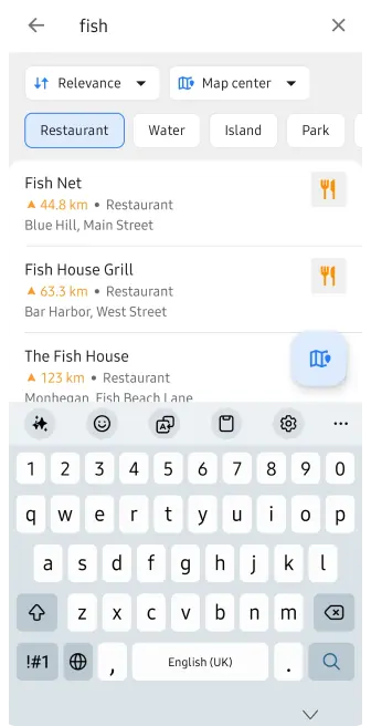
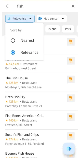
OsmAnd 5.4 (Android) OsmAnd 5.4 for Android is now available on the Google Play Store. Please update to the latest version to enjoy the new features and improvements. At this release, we focused on improving the search experience, making it easier to find places and discover objects around a specific location. We also added the ability to attach media files to Favorites and Waypoints, making them more informative and useful for your travels. 🔄 Update Now! Thanks to all our users for their feedback and suggestions. Your input is invaluable in helping us improve OsmAnd and make it the best navigation app for Android. What's new​ Refreshed search UI: sorting, category filters, cleaner look Attach photos and media to Favorites Favorites: subgroups support and pinnable folders New widgets appearance Roof shapes for 3D Buildings Coordinates: search, map grid, and POI display now support EPSG and Maidenhead locator Navigation settings improvements Android Auto updates Astronomy added solar & lunar eclipses AIS improvements New spatial search — find places and search around a place Others updates and improvements Bug fixes. Refreshed search UI​ We introduced a refreshed Search interface designed to make finding places faster and easier. You can now quickly choose where to search — around the Map Center or My Location — and select how results should be sorted: by Nearest or Relevance. It is also easier to narrow down the results by selecting one or multiple POI categories, so you can focus only on the places you are interested in. The updated interface makes Search more flexible, easier to understand, and faster to use. History search and filtering​ The Search History menu now gives you more control over what is displayed. You can filter history by item type and choose one or several categories: Tracks Locations Addresses POIs Favorites Photos Destinations By default, all history items are shown. You can also sort history by: Recent Nearest Nearest to Map Center An additional Type filter lets you display: All Search Navigation The History settings menu also includes an option to back up your history, helping you preserve your previous searches and navigation activity, make back up as file or clear all history. Attach photos and media to Favorites​ We've made Favorites and Waypoints more informative by allowing you to attach media files directly to them. Similar to the Audio/Video Notes feature, you can now add photos, videos, and audio notes to a saved Favorite or GPX Waypoint. You can take a new photo, record a video or audio note, or choose existing media from your device. Attached files are displayed in a new Media section directly in the Favorite or Waypoint context menu, so photos and recordings connected to a place are easy to access when you need them. This makes Favorites and Waypoints useful not only for saving a location, but also for keeping additional visual or audio information connected to that place. Subgroups support and pinnable folders for Favorites​ Managing large collections of Favorites is now much easier. Favorites can now be organized using folders and subfolders, similar to the folder structure already available for Tracks. This allows you to create a clear hierarchy instead of keeping all Favorite groups at the same level. For example, you can organize places like this: Netherlands / Amsterdam / Museums or create even deeper folder structures when needed. In My Places → Favorites, folders are displayed separately from individual Favorite points. You can create new folders, rename them, and move Favorites between folders and subfolders. The full folder path is also shown where it is useful, including the Favorite context menu, making it easier to understand where a saved place belongs. For long folder structures, OsmAnd automatically shortens the path while keeping the most important folder names visible. You can also pin important folders for quicker access to the Favorite groups you use most often. The new hierarchy is supported when moving and exporting Favorites and works with OsmAnd Cloud synchronization, while preserving the existing file-based Favorites structure. New widgets appearance​ We introduce new appearance settings for map widgets, giving you more control over how information is displayed on the map. Instead of configuring widgets only individually, you can now customize the appearance of each widget panel — Left, Right, Top, and Bottom — from a dedicated Appearance screen. For each panel, you can adjust: Widget or row size — Original, Small, Medium, or Large Widget icons — keep individual settings, show all, or hide all Text and secondary text colors Background color — Default, Transparent, or Custom A live preview shows how the selected settings will look directly while you configure them. For custom colors, Day and Night modes can be configured separately, helping keep widgets readable with different map styles and lighting conditions. You can also copy appearance settings from another widget panel or another profile, making it easier to keep a consistent layout across different OsmAnd profiles. Updated 3D Buildings​ OsmAnd 5.4 brings another major update to 3D Buildings, making cityscapes more detailed and closer to the real-world geometry stored in OpenStreetMap. Buildings can now display different roof shapes instead of being rendered only as simple flat-topped volumes. When the corresponding roof information is available in OpenStreetMap, OsmAnd uses it to create a more recognizable building silhouette. Rendering of complex buildings and building parts has also been improved. OsmAnd now handles structures divided into multiple building:part elements more accurately, including cases where only building:levels information is available instead of an explicit height. We also improved the rendering of buildings created from relations and multipolygons, fixing cases where individual sections or lower parts of complex structures could be missing from the 3D model. These changes make landmarks and detailed urban areas significantly more realistic when exploring the map in 3D. To enable the feature, go to: Menu → Configure map → Topography → 3D buildings Coordinates EPSG systems​ We expand support for coordinate systems, making the app more useful for professional mapping, field work, surveying, amateur radio, and other activities that rely on specific coordinate formats. You can now use EPSG coordinate systems and the Maidenhead Locator System across different parts of OsmAnd, including: Coordinate Search Map Grid POI and map context information In Coordinate Search, you can select recently used formats or browse the full list of available coordinate systems. You can also quickly find the required system by searching for its name or EPSG code. The Maidenhead Locator System is also supported on Android. It represents locations using a compact combination of letters and numbers and is commonly used by amateur radio operators. Coordinate formats can be configured separately for each OsmAnd profile. You can choose a Primary coordinate format, add other formats to the list, reorder them, or remove formats you do not need. Navigation settings improvements​ OsmAnd 5.4 improves navigation in situations where a route crosses regions with outdated or inconsistent offline maps. Previously, route calculation could be interrupted by several dialogs asking you to update maps or manually continue using the downloaded maps. In some cases, this could even happen during route recalculation while navigation was already active. Now, OsmAnd can handle these situations more smoothly. If the selected routing method cannot calculate the route correctly, the app can switch to an alternative calculation method and continue navigation without unnecessary interruptions. You can also control this behaviour manually in: Navigation settings → Route parameters → Route calculation method Here, you can choose the preferred routing calculation method depending on your needs. This makes route calculation more reliable when travelling across map borders or when not all downloaded maps were updated at the same time. Android Auto updates​ OsmAnd 5.4 brings several improvements to Android Auto, making the search, and navigation experience more convenient on the car display. More Useful Search Results​ Search results in Android Auto now show more information at a glance. For POIs, OsmAnd can display opening hours in a compact format, together with distance and address information. This makes it easier to see whether a restaurant, shop, fuel station, or another place is currently open before selecting it as your destination. Address presentation has also been simplified for nearby POIs, reducing unnecessary information on the limited Android Auto screen. Improved Navigation Controls​ Navigation controls have also been refined. The X button next to the ETA now correctly stops the active navigation, making it easier to finish a trip directly from the Android Auto interface. We also fixed interface issues on the arrival screen, including the duplicated Search button that could appear after reaching a destination. Together, these changes make Android Auto cleaner and easier to use while keeping important map, search, and navigation information accessible on the road. Astronomy added solar & lunar eclipses​ The Astronomy plugin continues to grow in OsmAnd 5.4 with new tools for exploring solar and lunar eclipses directly on the Star Map. Solar Eclipses​ You can now explore solar eclipses around the world and see how an eclipse develops over time. The new Solar Eclipse Explorer shows the eclipse shadow on the map and provides a timeline that you can move through to see how the event changes. Information is calculated for the selected location, making it possible to check whether and how the eclipse will be visible there. You can also quickly switch between previous and next solar eclipses and explore their paths in different parts of the world. Lunar Eclipses​ The Star Map now also includes a dedicated Lunar Eclipse Explorer, supporting: Penumbral eclipses Partial eclipses Total eclipses The eclipse timeline shows the different stages of the event, while the visualization demonstrates how the Moon moves through the Earth's penumbra and umbra. You can check the current eclipse phase, obscuration, Moon altitude, and where the eclipse is visible. A dedicated visibility layer on the map helps show the regions where the Moon is above the horizon during the event. Together, these additions turn the Astronomy plugin into a useful tool not only for exploring stars and planets, but also for planning and observing upcoming eclipses. AIS improvements​ OsmAnd 5.4 brings several improvements to the Vessel Tracker (AIS) plugin, making it easier to configure AIS connections and monitor nearby vessels. The plugin settings have been reorganized into clearer sections for Connection, Object visibility, and Collision avoidance alarms (CPA). You can configure AIS data reception using TCP or UDP, with connection information and status displayed directly in the interface. New Object visibility settings give you more control over outdated AIS targets. You can define when a vessel should be marked as outdated and how long it should remain visible on the map after its signal is lost. The Collision Avoidance Alarm (CPA) settings have also been redesigned. You can configure: Warning time (TCPA) — how far in advance OsmAnd should warn about a potential collision. Closest Point of Approach (CPA) — the minimum safe distance between your vessel and another AIS target. When another vessel is predicted to come too close within the configured time, OsmAnd can highlight it as a potential collision risk. AIS visibility can also be managed as a dedicated map layer through Configure Map, making it easier to enable or disable vessel information when needed. New spatial search​ Experimental feature: In OsmAnd 5.4 for Android, the new Spatial Search is disabled by default. To enable it, go to: OsmAnd Development plugin → Use spatial text search. This allows us to collect feedback and continue improving the search experience before enabling it by default in a future release. Previously, search was largely tied to your current location and the way individual words in a query were interpreted. The new approach takes geographical context into account, making combinations such as a place name + POI, category, street, or address much easier to understand. For example, you can find a city or another place first and then search for cafĂ©s, restaurants, hotels, shops, fuel stations, or other POIs around that location. This is especially useful when planning a trip somewhere else instead of searching only near your current position. The new search engine also improves how OsmAnd handles more complex queries, including combinations such as "Hotel Berlin", a POI together with a street or city, different street-name formats, translated category names, and other location-based searches. Under the hood, this is more than an interface update. Our backend team introduced a new search architecture called Spatial Search by Name, designed to provide more relevant results and resolve many limitations of the previous search system. Search by supported POI categories has also been optimized for faster results. Others updates and improvements​ More track details in What's Here. Track information now makes it easier to distinguish between tracks on the map, including identifying the folder where a track is stored. More icons for profiles. The profile icon selection has been expanded, giving you more options to visually distinguish profiles for activities such as running and other use cases. Extended AIDL support for external apps. External apps and plugins can now organize their OsmAnd widgets into groups and use custom widget icons, providing more flexibility for third-party integrations. Correct altitude on Android 16. Fixed an issue where OsmAnd could display ellipsoidal altitude instead of altitude above mean sea level (MSL) on Android 16 devices. Bug fixes​ Fixed multiple URLs separated by semicolons being displayed and opened as a single link. Fixed the Open on map action in Travel Guides. Fixed copying widget panels and layouts from another profile. Improved performance when opening GPX waypoint descriptions by resolving intermittent UI freezes. Fixed widgets disappearing from Analyze on map after returning to OsmAnd from another app. Fixed imported multi-segment tracks not appearing immediately after import. Corrected incorrectly calculated storage size for Favorites and Favorite folders. Fixed synchronization between elevation, road type, surface, and other graphs in route details. Improved external sensor widgets by showing the correct disconnected state and resetting values after stopping. Fixed a visual gap between the current location marker and the route line during navigation. Fixed Favorite folder colors being reset after an app update. Fixed deleted Favorites unexpectedly reappearing on the map. Fixed outdated 3D Terrain maps not appearing in the Updates list. Improved sorting of Favorites by proximity to the selected map area. Fixed the location marker being hidden or positioned outside the visible map area in Android split-screen mode. Fixed navigation incorrectly ending after switching to another app and returning to OsmAnd. Improved navigation stability by fixing a resource leak that could cause crashes during longer trips. Improved pinned Favorites folder behavior so folder state is preserved correctly after restarting the app. Improved handling of very large tracks to reduce out-of-memory crashes when working with tracks containing hundreds of thousands of points. Fixed incorrect 3D track rendering when using Speed as the visualization parameter. If you have suggestions for improving the Android version of the app, please get in touch with us. We appreciate and welcome your contribution to the further development of OsmAnd. Follow: Follow OsmAnd on Facebook, TikTok, X (Twitter), Reddit, and Instagram! Join: Join us at our groups of Telegram (OsmAnd News channel), (EN), (IT), (FR), (DE), (UA), (ES), (BR-PT), (PL), (AR), (TR). Get: https://osmand.net/blog/osmand-android-5-4-released

OsmAnd (Unofficial)
OsmAnd (Unofficial) 21d

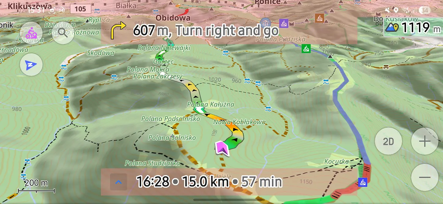
Working with Color Palettes for Tracks and Terrain You've ridden the Transfagarasan three times now, and the story you tell afterward never changes: good climb, brutal hairpins, freezing at the top. Same three sentences, every time, because that's genuinely all a memory holds onto. Your phone remembers more. It was recording the whole ride — every meter of elevation, every km/h, the exact spot where you stopped pretending you weren't struggling. None of that shows up in a photo. It shows up in the track, if you know how to ask it the right question. Photo by Tiberiu Potec on Unsplash Giving Color to Your Ride​ Standard monochromatic lines on a map tell you where you went, but they remain completely silent about how the ride actually felt. OsmAnd solves this by allowing you to color your tracks using real ride data — Speed, Altitude, or Slope. Color transforms a flat line into a visual profile of your physical effort. A steep climb up the southern approach of the Fagaras Mountains shifts into warm, intense gradients, while steady valley roads cool down into gentle tones. However, default track coloring relies on generalized scales that don't always capture the nuances of specific terrain or activity types. To give your map absolute visual accuracy, OsmAnd Pro includes the Color Palette Editor — an advanced tool available with an OsmAnd Pro subscription that gives you complete control over how data thresholds map to visual colors. Relative vs. Fixed Values: Choosing the Right Scaling​ When creating or customizing a palette in the editor, you choose between two fundamentally different ways to interpret data. Using a Relative palette, colors scale automatically based on the specific track's minimum, average, and maximum values. If your ride spans from 600 meters at the base to 2,034 meters at the Bălea Tunnel summit, the gradient stretches evenly across that exact range. This mode is ideal for isolated rides where you want the highest possible visual contrast across a single trip. A Fixed Values palette operates differently by assigning colors to specific, absolute numbers, such as 10 km/h, 50 km/h, or exact elevation steps like 600 m, 1,200 m, and 2,000 m. The scale remains constant regardless of which track it is applied to. This approach is essential when comparing multiple rides or setting personal benchmarks, as 2,000 meters of elevation or a 10% slope gradient will always render in the exact same color across every track on your map. Working with the Color Palette Editor​ Accessing the editor is seamlessly integrated into your track's appearance settings. Opening the track's Appearance menu, selecting a data-based color mode, and tapping the palette icon opens the All colors screen. Here, tapping the + button allows you to build a new palette in either Relative or Fixed Values format. The editor provides an intuitive set of tools for fine-tuning your data visuals. At the top of the screen, a live gradient preview reflects your changes in real time as you adjust values. You can add new threshold steps using the + Add step button, assign custom colors, or remove unneeded steps to simplify the scale. The editor also automatically respects your system profile settings, seamlessly displaying values in metric or imperial units — such as meters, feet, km/h, or mph — without disrupting your underlying color scales. Mountain terrain frequently introduces data gaps. As you ride through the 900-meter Bălea Tunnel near the summit, GPS reception naturally drops. To handle these moments, the editor includes a dedicated No Data step, letting you assign a distinct, neutral color to track segments where logging was temporarily interrupted. Managing your personal collection of palettes on the All colors screen is equally simple. Opening the three-dot menu next to any custom palette provides quick options to rename, edit, duplicate, or delete it whenever your preferences change. Harmonizing Track and Terrain Colors​ A custom track palette works best when it stands out clearly against the underlying map background. If your elevation track uses deep red shades for high mountain peaks, those segments might blend into intense terrain contour lines or dark relief shading. OsmAnd allows you to customize map background palettes as well, giving you the flexibility to adjust elevation and slope visualizations under Menu → Configure map → Terrain → Color scheme on Android, or Visualization on iOS. Selecting complementary terrain color scales keeps your track lines sharp and legible, whether you are navigating dense forest valleys or barren, high-altitude alpine passes. While custom palettes can be applied across various terrain layers, keep in mind that Hillshade relies on a fixed shading algorithm and operates independently of custom palettes. Customize Your Map Experience​ Custom color palettes allow you to turn complex GPX data into clear, meaningful visual stories. Whether you are analyzing steep mountain passes or setting up standardized color scales for daily training routes, full control over your track visuals is right at your fingertips. This feature is part of our latest release updates. Take a moment to explore our new release blog posts to discover all the new tools, optimizations, and features we've recently added to make your navigation experience even better! We appreciate your interest in us and thank you for taking the time to read this article. Join us on social media to keep up to date with the latest news and share your experiences. Your opinion is important to us. Follow OsmAnd on Facebook, TikTok, X (Twitter), Reddit, and Instagram! Join us at our groups of Telegram: (OsmAnd News channel), (EN), (IT), (FR), (DE), (UA), (ES), (BR-PT), (PL), (AR), (TR). https://osmand.net/blog/color-palettes

Welcome to OsmAnd (Unofficial) spacestr profile!

About Me

Offline maps and open navigation projects. Unofficial automated fan feed. Content belongs to its respective owners; not affiliated with source publishers.

Interests

  • No interests listed.

Videos

Music

My store is coming soon!

Friends